
Current progress
1,292 individual records
378 households
34 pages of census records
29 contributors
1,292 individual records
378 households
34 pages of census records
29 contributors
1940 Census of Athens
After 72 years, the U.S. Census releases all individual-level responses to their surveys to the general public. That means in that responses to the 1940 census have been public since 2012 (and 1950 responses will become public in 2022).
To provide insight into Athens' history, the CML is sponsoring a digitization of these scanned records for Clarke County. These data are already available through genealogical services like Ancestry, but our work will create a fully public dataset that can tell us more about the people who lived and worked in the city and the patterns of segregation that shaped their lives.
To provide insight into Athens' history, the CML is sponsoring a digitization of these scanned records for Clarke County. These data are already available through genealogical services like Ancestry, but our work will create a fully public dataset that can tell us more about the people who lived and worked in the city and the patterns of segregation that shaped their lives.
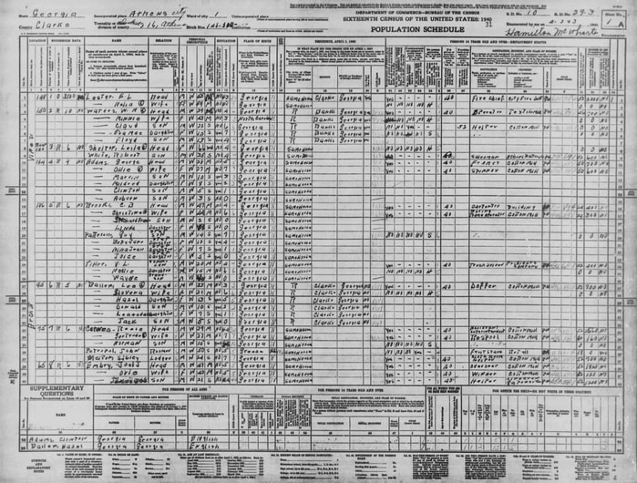
Page from the census rolls for the 1940 census in Athens
Here's a short walkthrough of the process we are using for digitization:
For those who are contributing to this effort, links to resources are found below:
Map of the enumeration districts Online images of the census records:
- From the National Archives: 1940census.archives.gov/getting-started/
- Look for the "Do you know the 1940 enumeration district number?" heading. Pick Georgia as your state and type in the appropriate district ID (e.g., 29-1)
- Description from the National Archives
- Our codebook and guide for data entry: Link
- PDF of the census form (National Archives)
- Explanation of census headers from the genealogy girl: Link
- Athens city directory in 1940: Use for looking up hard to read names!
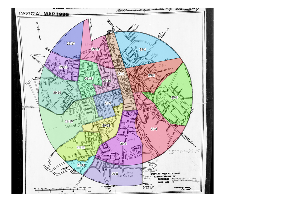
Map of the 1940 enumeration districts
Georeferenced version of this digitized map: Link
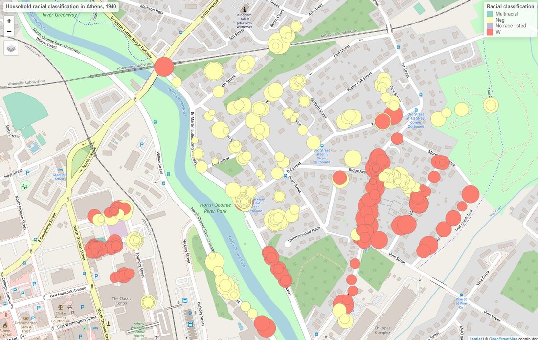
Household racial segregation in enumeration district 29-2. Size of dots reflects number of residents.