Community Mapping Lab
  • Home
  • About
    • Our mission
    • Who we are
    • Partners
    • Contact
  • Activties
    • Community GIS (Geog4/6385)
    • Mapping with QGIS
    • ICC Open GIS workshop
    • CommGeog19
  • Projects
    • Athens Wellbeing Project
    • ACC Black-owned businesses
    • Athens bike routes
    • Atlanta Community Food Bank
    • Athens 1958 City Directory
    • Food resources in Athens
    • Georgia Initiative for Community Housing
    • Historic Cobbham Neighborhood
    • Linnentown
    • New ACC districts-2022
    • Sparrow's Nest
    • Stores
  • Blog
  • Resources
  • Calendar

Athens bike routes

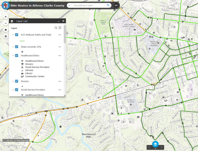
Through a collaboration between BikeAthens, the CML, and faculty at the College of Environment and Design at UGA, we are developing a map of suggested bike routes throughout Athens Clarke County. Initial draft routes were created by identifying over 600 points of interest throughout the county and using multiple routing services to identify common paths that linked those points. The current draft routes and selected points of interest are shown below. At this point, these routes are purely informational and do not reflect any plans to add or enhance bike lanes in the city.

An initial map of these routes is available here: bit.ly/Athensbikemap
We are currently asking for community feedback to finalize these routes. Click this link to go to the survey.
Picture

About us

Courses

Projects

  • Home
  • About
    • Our mission
    • Who we are
    • Partners
    • Contact
  • Activties
    • Community GIS (Geog4/6385)
    • Mapping with QGIS
    • ICC Open GIS workshop
    • CommGeog19
  • Projects
    • Athens Wellbeing Project
    • ACC Black-owned businesses
    • Athens bike routes
    • Atlanta Community Food Bank
    • Athens 1958 City Directory
    • Food resources in Athens
    • Georgia Initiative for Community Housing
    • Historic Cobbham Neighborhood
    • Linnentown
    • New ACC districts-2022
    • Sparrow's Nest
    • Stores
  • Blog
  • Resources
  • Calendar