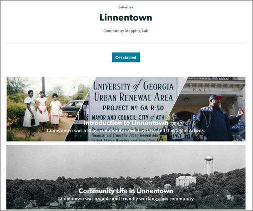
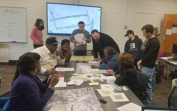
Linnentown was an African-American neighborhood close to the UGA campus that was destroyed to make room for student housing in the early 1960s. The map below shows the boundary of this historic neighborhood. Starting in Spring 2020, the Community Mapping Lab partnered with the Linnentown Project and the Athens-Clarke County Justice and Memory Project to digitize and analyze records related to the community from UGA's special collections library and do other work that makes this history more publicly available.
More detail on the 2020 collaboration is found on this blog post, but also briefly summarized below. A subsequent class in Spring 2022 built on this work, and Dr. Shannon also led a team of researchers in estimating the financial value of property losses for Linnentown home owners.
More detail on the 2020 collaboration is found on this blog post, but also briefly summarized below. A subsequent class in Spring 2022 built on this work, and Dr. Shannon also led a team of researchers in estimating the financial value of property losses for Linnentown home owners.
Assessing financial losses from urban renewal in Linnentown (Spring 2022)
Working with the Athens-Clarke County mayor's office and the ACC Justice and Memory Project, Dr. Jerry Shannon, along with Dr. Richard Martin and Ph.D. candidate Aidan Hysjulien, created estimates of the financial losses to Linnentown property owners as a result of their displacement. The report below provides the results of this research. Our final estimate is as follows:
- Total property-related losses: $5,022,375
- Losses from underpayment: $4,027,789
- Losses from lower appreciation rates after relocation: $994,586
A recorded presentation on this report to the Athens-Clarke County Commission is also available.
Your browser does not support viewing this document. Click here to download the document.
Linnentown Storymap and Virtual Walking Tour (Community GIS: Spring 2022)
The Community GIS class in Spring 2022 worked with Ms. Hattie Thomas Whitehead and others to create a digital storymap for the Linnentown neighborhood, including a virtual tour with Ms. Hattie and Mr. Bobby Crook. Access that storymap using this link.
Digitizing archival records on the R-50 project (Community GIS: Spring 2020)
Working from archival maps and satellite photos, students in the Spring 2020 Community GIS class mapped parcel boundaries, homes, and streets related to the neighborhood, including information on property owners and residents. We used sketch mapping with former residents to capture details that were either inaccurate or missing in the archival records.
In addition, we digitized individual level records from the 1940 Census to better understand what the neighborhood was like in the years prior to its destruction. A Ph.D. student at University of Liverpool, Hope Bleasdale, helped analyze these data, and you can see her results on this page.
For their final projects, students created storymaps or dashboards based on the data we compiled over the semester. You can see presentations for selected projects (along with links to those maps) using the YouTube video playlist below--projects will play consecutively. Alternatively, here's the link to the playlist on YouTube and a list of final projects. You can also see reflections on the class on our blog from Aidan and Katrina.
You can also watch this presentation project at the NACIS 2020 annual meeting below:


