Community Mapping Lab
  • Home
  • About
    • Our mission
    • Who we are
    • Partners
    • Contact
  • Activities
    • Community GIS (Geog4/6385)
    • CURO
    • Mapping with QGIS
    • CommGeog19
  • Projects
    • Athens Black history and places >
      • ACC Black-owned businesses
      • Black history sites in Athens
      • Brooklyn Cemetery
      • Linnentown
      • Hot Corner
      • Reese Street
    • Athens Wellbeing Project
    • Athens 1958 City Directory
    • Athens bike routes
    • Atlanta Community Food Bank
    • Evictions in Athens
    • Digitizing Athens Sanborn Maps
    • GA Hunger study: Proximity map
    • Georgia Initiative for Community Housing
    • Historic Cobbham Neighborhood
    • R-51 and urban renewal in Athens
    • Sparrow's Nest
  • Blog
  • Resources
  • Calendar

Mapping with QGIS

Overview

Picture
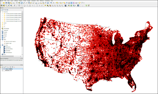
QGIS is the leading open source desktop GIS applications. These workshops provide an introduction to working with geographic data and opportunity to learn how to use this freely available software. This course is co-taught through a partnership with the UGA Map and Government Information Library. Currently, we offer two sessions:

Session 1: Getting started with GIS
  • Working with geographic data: vector and raster
  • Using visual variables to map data values
  • Creating print maps
​
Session 2: Basic data manipulation
  • Working with map projections
  • Joining spreadsheets to geographic data
  • Using spatial functions (e.g., clip, select by location, buffer)

Course materials

The links below provide links to relevant course materials.
  • Download QGIS
  • QGIS tutorials page
  • Session 1
    • Download the data
    • Slide presentation for the class
    • Lab walkthrough instructions
  • Session 2​
    • Download the data
    • Slide presentation for the class
    • Lab walkthrough instructions

About us

Courses

Projects

  • Home
  • About
    • Our mission
    • Who we are
    • Partners
    • Contact
  • Activities
    • Community GIS (Geog4/6385)
    • CURO
    • Mapping with QGIS
    • CommGeog19
  • Projects
    • Athens Black history and places >
      • ACC Black-owned businesses
      • Black history sites in Athens
      • Brooklyn Cemetery
      • Linnentown
      • Hot Corner
      • Reese Street
    • Athens Wellbeing Project
    • Athens 1958 City Directory
    • Athens bike routes
    • Atlanta Community Food Bank
    • Evictions in Athens
    • Digitizing Athens Sanborn Maps
    • GA Hunger study: Proximity map
    • Georgia Initiative for Community Housing
    • Historic Cobbham Neighborhood
    • R-51 and urban renewal in Athens
    • Sparrow's Nest
  • Blog
  • Resources
  • Calendar